United Kingdom
United Kingdom map

United Kingdom administrative divisions
United Kingdom comprises four constituent countries:
- England
- Scotland
- Wales
- Northern Ireland
England:
24 two-tier counties, 32 London boroughs and 1 City of London or Greater London, 36 metropolitan districts, 59 unitary authorities (including 4 single-tier counties*);
two-tier counties:
- Cambridgeshire,
- Cumbria,
- Derbyshire,
- Devon,
- East Sussex,
- Essex,
- Gloucestershire,
- Hampshire,
- Hertfordshire,
- Kent,
- Lancashire,
- Leicestershire,
- Lincolnshire,
- Norfolk,
- North Yorkshire,
- Nottinghamshire,
- Oxfordshire,
- Somerset,
- Staffordshire,
- Suffolk,
- Surrey,
- Warwickshire,
- West Sussex,
- Worcestershire
London boroughs and City of London or Greater London:
- Barking and Dagenham,
- Barnet,
- Bexley,
- Brent,
- Bromley,
- Camden,
- Croydon,
- Ealing,
- Enfield,
- Greenwich,
- Hackney,
- Hammersmith and Fulham,
- Haringey,
- Harrow,
- Havering,
- Hillingdon,
- Hounslow,
- Islington,
- Kensington and Chelsea,
- Kingston upon Thames,
- Lambeth,
- Lewisham,
- City of London,
- Merton,
- Newham,
- Redbridge,
- Richmond upon Thames,
- Southwark,
- Sutton,
- Tower Hamlets,
- Waltham Forest,
- Wandsworth,
- Westminster
metropolitan districts:
- Barnsley,
- Birmingham,
- Bolton,
- Bradford,
- Bury,
- Calderdale,
- Coventry,
- Doncaster,
- Dudley,
- Gateshead,
- Kirklees,
- Knowlsey,
- Leeds,
- Liverpool,
- Manchester,
- Newcastle upon Tyne,
- North Tyneside,
- Oldham,
- Rochdale,
- Rotherham,
- Salford,
- Sandwell,
- Sefton,
- Sheffield,
- Solihull,
- South Tyneside,
- St. Helens,
- Stockport,
- Sunderland,
- Tameside,
- Trafford,
- Wakefield,
- Walsall,
- Wigan,
- Wirral,
- Wolverhampton
unitary authorities:
- Bath and North East Somerset,
- Bedford,
- Blackburn with Darwen,
- Blackpool,
- Bournemouth,
- Christchurch and Poole,
- Bracknell Forest,
- Brighton and Hove,
- City of Bristol,
- Buckinghamshire,
- Central Bedfordshire,
- Cheshire East,
- Cheshire West and Chester,
- Cornwall,
- Darlington,
- Derby,
- Dorset,
- Durham County*,
- East Riding of Yorkshire,
- Halton,
- Hartlepool,
- Herefordshire*,
- Isle of Wight*,
- Isles of Scilly,
- City of Kingston upon Hull,
- Leicester,
- Luton,
- Medway,
- Middlesbrough,
- Milton Keynes,
- North East Lincolnshire,
- North Lincolnshire,
- North Northamptonshire,
- North Somerset,
- Northumberland*,
- Nottingham,
- Peterborough,
- Plymouth,
- Portsmouth,
- Reading,
- Redcar and Cleveland,
- Rutland,
- Shropshire,
- Slough,
- South Gloucestershire,
- Southampton,
- Southend-on-Sea,
- Stockton-on-Tees,
- Stoke-on-Trent,
- Swindon,
- Telford and Wrekin,
- Thurrock,
- Torbay,
- Warrington,
- West Berkshire,
- West Northamptonshire,
- Wiltshire,
- Windsor and Maidenhead,
- Wokingham,
- York
Northern Ireland:
- 5 borough councils,
- 4 district councils,
- 2 city councils;
borough councils:
- Antrim and Newtownabbey;
- Ards and North Down;
- Armagh City, Banbridge, and Craigavon;
- Causeway Coast and Glens;
- Mid and East Antrim
district councils:
- Derry City and Strabane;
- Fermanagh and Omagh;
- Mid Ulster;
- Newry, Murne, and Down
city councils:
- Belfast;
- Lisburn and Castlereagh
Scotland:
32 council areas:
- Aberdeen City,
- Aberdeenshire,
- Angus,
- Argyll and Bute,
- Clackmannanshire,
- Dumfries and Galloway,
- Dundee City,
- East Ayrshire,
- East Dunbartonshire,
- East Lothian,
- East Renfrewshire,
- City of Edinburgh,
- Eilean Siar (Western Isles),
- Falkirk,
- Fife,
- Glasgow City,
- Highland,
- Inverclyde,
- Midlothian,
- Moray,
- North Ayrshire,
- North Lanarkshire,
- Orkney Islands,
- Perth and Kinross,
- Renfrewshire,
- Shetland Islands,
- South Ayrshire,
- South Lanarkshire,
- Stirling,
- The Scottish Borders,
- West Dunbartonshire,
- West Lothian
Wales:
22 unitary authorities:
- Blaenau Gwent,
- Bridgend,
- Caerphilly,
- Cardiff,
- Carmarthenshire,
- Ceredigion,
- Conwy,
- Denbighshire,
- Flintshire,
- Gwynedd,
- Isle of Anglesey,
- Merthyr Tydfil,
- Monmouthshire,
- Neath Port Talbot,
- Newport,
- Pembrokeshire,
- Powys,
- Rhondda Cynon Taff,
- Swansea,
- The Vale of Glamorgan,
- Torfaen,
- Wrexham
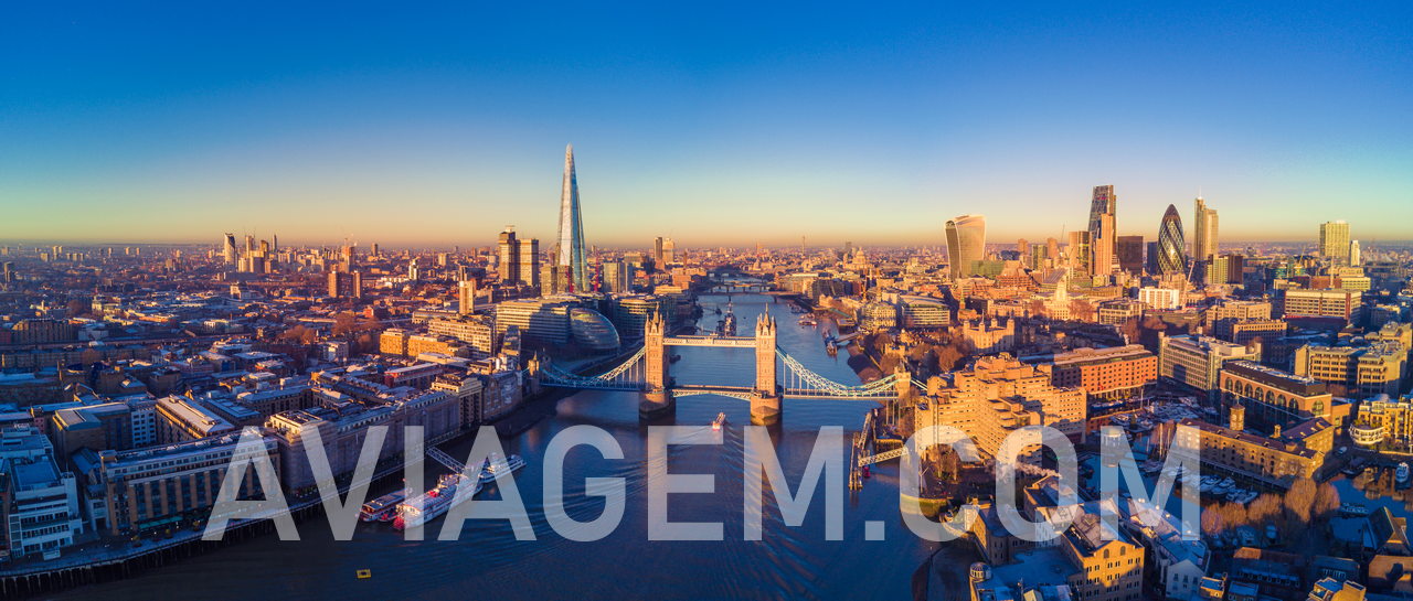
London, United Kingdom capital city

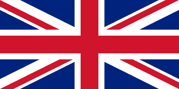
United Kingdom flag

What continent does United Kingdom fall under?
Most spoken language in United Kingdom, by order
English. The following are recognized regional languages: Scots (about of the population of Scotland), Scottish Gaelic (about 60,000 speakers in Scotland), Welsh (about of the population of Wales), Irish (about of the population of Northern Ireland), Cornish (some 2,000 to 3,000 people in Cornwall)
English is spoken by 5.1% of the World population! United Kingdom, Ireland, United States of America, Australia, Isle of Man, Montserrat, Guam, Jamaica, Gibraltar, Falkland Islands, Wallis and Futuna, Belize, Saint Helena, Uganda, Puerto Rico, Eswatini, Micronesia, Sierra Leone, Guernsey, Vietnam, Cocos (Keeling) Islands, Netherlands, Suriname, New Caledonia, Iceland, Saint Vincent and the Grenadines, United Arab Emirates, Tokelau, Kuwait, Liberia, South Korea, Qatar, Jordan, Monaco, Saint Barthelemy, Chile, Argentina, Bahrain, Oman, Costa Rica, Egypt, Laos, Lebanon, Hungary, Libya, Malaysia, Brunei, Saint Martin, Greece, Cyprus, Madagascar, Indonesia, Nauru, Israel, Solomon Islands, Maldives, Mauritius, Marshall Islands, Macau, Syria, Denmark, Tanzania, New Zealand, American Samoa, Greenland, Afghanistan, Switzerland, Sao Tome and Principe, Zimbabwe, Aruba, Sri Lanka, Kazakhstan, Pakistan, Thailand, Ghana, India, Ethiopia, Luxembourg, Panama, Brazil, Somalia, Timor Leste, Nepal
The English language code is en
Geographical position of United Kingdom in the world
Western Europe, islands - including the northern one-sixth of the island of Ireland - between the North Atlantic Ocean and the North Sea; northwest of France
How is United Kingdom climate?
temperate; moderated by prevailing southwest winds over the North Atlantic Current; more than one-half of the days are overcast
What are United Kingdom neighbours?
Ireland.
What is United Kingdom most predominant religion?
Christian (includes Anglican, Roman Catholic, Presbyterian, Methodist),
and United Kingdom second most predominant religion
Muslim,
and other practiced religions in United Kingdom ?
Hindu
What is United Kingdom ISO country code?
GB
and United Kingdom ISO3
GBR
United Kingdom country area
244820 sq km
What is United Kingdom country population?
66,488,991
What is United Kingdom time zone?
- UTC −08:00 — Pitcairn Islands
- UTC −05:00 — Cayman Islands, Turks and Caicos Islands
- UTC −04:00 (AST - Alaska Standard Time) — Anguilla, Bermuda, British Virgin Islands, Montserrat
- UTC −03:00 (FKST - Falkland Islands Summer Time) — Falkland Islands
- UTC −02:00 — South Georgia and the South Sandwich Islands
- UTC ±00:00 (GMT - Greenwich Mean Time in winter/BST in summer) — main territory of the United Kingdom, Saint Helena, Ascension and Tristan da Cunha, Guernsey, Isle of Man, Jersey
- UTC +01:00 Central European Time — Gibraltar
- UTC +02:00 (EET - Eastern European Time) — Akrotiri and Dhekelia
- UTC +06:00 — British Indian Ocean Territory
What is internet country code(ccTLD) used to indicate the United Kingdom websites?
The websites ccTLD used in United Kingdom is .uk
United Kingdom calling code
Calling from a different country, everyone should use the prefix 44 before the United Kingdom phone number
United Kingdom Global Peace Index Rank
According to visionofhumanity.org, United Kingdom ranks at position 33 of the Global Peace Index Rank, with a Global Peace Index Score of 1.658
The currency name used in United Kingdom is the Pound with the currency code GBP
What has been United Kingdom GPD per capita evolution in the last years?
United Kingdom GDP per capita, according to CIA, has been of $41,600 (2020 est.) ,
$46,400 (2019 est.) and $46,000 (2018 est.) data are in 2017 US dollars.
United Kingdom
GDP per capita is in rank 40 compared to other countries in the world, with a value of
$41,600 - data from 2020
The monthly minimum wage in local currency in United Kingdom is 1.536,2 £ an approximate equivalence to 1.708,7 € (euros), values of 2021
Projet "A Viagem" aviagem.com
GO TO PAGE Countries & World Maps
World countries (links), separated into columns by continent
numerically sorted by country population size