Kiribati
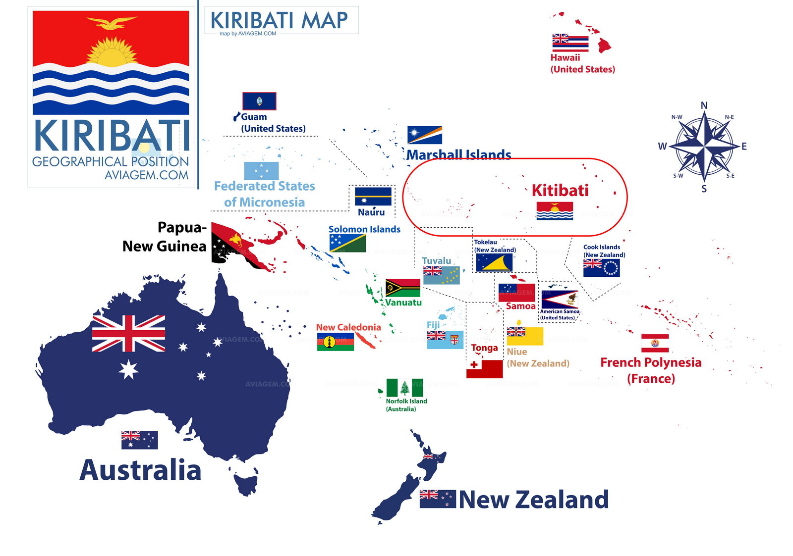
Kiribati map

Kiribati administrative divisions
3 geographical units: Gilbert Islands, Line Islands, Phoenix Islands; there are no first-order administrative divisions, but there are 6 districts
-
Banaba,
Central Gilberts,
Line Islands,
Northern Gilberts,
Southern Gilberts,
Tarawa)
and 21 island councils - one for each of the inhabited islands
- Abaiang,
- Abemama,
- Aranuka,
- Arorae,
- Banaba,
- Beru,
- Butaritari,
- Kanton,
- Kiritimati,
- Kuria,
- Maiana,
- Makin,
- Marakei,
- Nikunau,
- Nonouti,
- Onotoa,
- Tabiteuea,
- Tabuaeran,
- Tamana,
- Tarawa,
- Teraina
Tarawa, Kiribati capital city

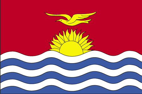
Kiribati flag

What continent does Kiribati fall under?
Most spoken language in Kiribati, by order
I-Kiribati, English (official)
English is spoken by 5.1% of the World population! United Kingdom, Ireland, United States of America, Australia, Isle of Man, Montserrat, Guam, Jamaica, Gibraltar, Falkland Islands, Wallis and Futuna, Belize, Saint Helena, Uganda, Puerto Rico, Eswatini, Micronesia, Sierra Leone, Guernsey, Vietnam, Cocos (Keeling) Islands, Netherlands, Suriname, New Caledonia, Iceland, Saint Vincent and the Grenadines, United Arab Emirates, Tokelau, Kuwait, Liberia, South Korea, Qatar, Jordan, Monaco, Saint Barthelemy, Chile, Argentina, Bahrain, Oman, Costa Rica, Egypt, Laos, Lebanon, Hungary, Libya, Malaysia, Brunei, Saint Martin, Greece, Cyprus, Madagascar, Indonesia, Nauru, Israel, Solomon Islands, Maldives, Mauritius, Marshall Islands, Macau, Syria, Denmark, Tanzania, New Zealand, American Samoa, Greenland, Afghanistan, Switzerland, Sao Tome and Principe, Zimbabwe, Aruba, Sri Lanka, Kazakhstan, Pakistan, Thailand, Ghana, India, Ethiopia, Luxembourg, Panama, Brazil, Somalia, Timor Leste, Nepal
The English language code is en
Geographical position of Kiribati in the world
Oceania, group of 32 coral atolls and one raised coral island in the Pacific Ocean, straddling the Equator; the capital Tarawa is about halfway between Hawaii and Australia
How is Kiribati climate?
tropical; marine, hot and humid, moderated by trade winds
What are Kiribati neighbours?
Kiribati nearby islands include Fiji, Nauru, Marshall Islands, Samoa, French Polynesia, Cook Islands, and Tonga.
What is Kiribati most predominant religion?
Roman Catholic,
and Kiribati second most predominant religion
Kiribati Uniting Church,
and other practiced religions in Kiribati ?
Christ of Jesus Christ, Baha'i, Seventh Day Adventist
What is Kiribati ISO country code?
KI
and Kiribati ISO3
KIR
Kiribati country area
811 sq km
What is Kiribati country population?
115,847
What is Kiribati time zone?
- UTC +12:00 — Gilbert Islands
- UTC +13:00 — Phoenix Islands
- UTC +14:00 — Line Islands
What is internet country code (ccTLD) used to indicate the Kiribati websites?
The websites ccTLD used in Kiribati is .ki
Kiribati calling code
Calling from a different country, everyone should use the prefix 686 before the Kiribati phone number
Kiribati Global Peace Index Rank
According to visionofhumanity.org, Kiribati ranks at position of the Global Peace Index Rank, with a Global Peace Index Score of
The currency name used in Kiribati is the Dollar with the currency code AUD
What has been Kiribati GPD per capita evolution in the last years?
Kiribati GDP per capita, according to CIA, has been of $2,300 (2020 est.), $2,300 (2019 est.) and $2,300 (2018 est.) data are in 2017 US dollars.
Kiribati GDP per capita is in rank 206 compared to other countries in the world , with a value of $2,300 - data from 2020
Projet "A Viagem" aviagem.com
GO TO PAGE Countries & World Maps
World countries (links), separated into columns by continent
numerically sorted by country population size